In Hill & Harbor, the Cove Is Zoned Twice, and the Line Isn't on Your Plat Map
September 10, 2026
September 10, 2026
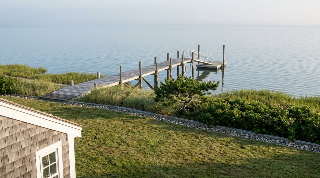
Picture two houses on Greenwich Cove, close enough that a kayaker could cross between them in under a minute. Both have frontage. Both have a view of the same water, the same sunset, the same line of moored sailboats drifting in the current. One owner can maintain a dock indefinitely. The other, technically, cannot add one at all, no matter how much they're willing to spend on permitting.
The difference has nothing to do with the house, the lot size, or the owner's relationship with the town. It comes down to an invisible line the state drew through the water itself, decades ago, and that line does not track the shoreline the way a buyer would expect.
Rhode Island's Coastal Resources Management Council, known as CRMC, doesn't just regulate what happens on land near the water. It classifies the water. Every stretch of shoreline in the state falls into one of several official Water Types, and Greenwich Cove is split between two of them.
Part of the cove carries a Type 1 designation, reserved for water the state considers a conservation priority, the kind of classification that treats permanent structures like seawalls as largely off the table. The rest carries a Type 5 designation, meaning commercial and recreational harbor use, the classification that expects docks, moorings, and marina activity as a matter of course.
CRMC didn't leave the boundary vague. Its own maps describe the line separating these zones using fixed points any longtime resident would recognize: a straight line running from the tip of Long Point at Goddard Park to a corner of the Marina Perimeter Limit at Norton's Marina, and another line running due east from the East Greenwich Town Dock. Those two lines box in the harbor's Type 5 water. Everything outside them reverts to the more restrictive designation.
None of that shows up on a standard plat map. A buyer comparing two waterfront listings in Hill & Harbor can be comparing two entirely different sets of development rights and never know it until an engineer or CRMC staffer traces the coordinates.
Even inside the more permissive Type 5 water, buildable does not mean permanently built. CRMC assents, the permits required for any dock, pier, or shoreline structure within 200 feet of the coast, are typically valid for three years from the date they're issued, according to CRMC's own program guidance. After that, the owner needs an extension or a fresh application, not a rubber stamp.
That timeline rarely lines up with how long people actually own waterfront homes. A dock permitted the year a family bought the house can lapse a decade before they sell it, quietly, with no notice mailed to anyone. The structure stays in the water. The paperwork behind it does not.
CRMC's own application form asks every new applicant whether they or a previous owner ever filed for or received an assent for any activity on the property, and requires the file number if so. That question exists because the agency has seen the same pattern often enough to build a checkbox for it: new owner, old dock, no current authorization on file.
This is the same shape of problem Newport sellers run into with the city's Certificate of Appropriateness process, where an approval is tied to a specific scope of work and a one-year clock rather than to the house itself. Hill & Harbor's version runs on a different regulator and a longer clock, three years instead of one, but the trap is identical. Whatever was approved belongs to the project, not the deed.
Even where a structure is allowed outright, how close it can sit to the water is governed by a formula, not a fixed number. Under the Greenwich Bay Special Area Management Plan, the coastal plan written specifically for this cove, buffer zone requirements are calculated based on a property's structural lot coverage rather than a flat setback distance. A smaller, more built-out lot and a larger, less developed one can face different required buffer widths even sitting on identical water.
Where an applicant can't meet the standard buffer, the plan allows a variance of up to 50 percent of the required width to be granted administratively by CRMC's executive director, provided the applicant satisfies the burden of proof. Ask for more than that, and the request goes to the full council for a public vote instead of a staff-level decision. That distinction alone can add months to a renovation timeline for anyone trying to expand a deck or add square footage close to the buffer line.
The pressure on this stretch of shoreline isn't theoretical. The Court at Rope Walk Hill, a new luxury condominium project inside the Hill & Harbor District, has already completed its first phase and is taking reservations for a second, with four deed-restricted units anticipated to finish in 2027. Listings for the project lean hard on proximity to Greenwich Bay and the district's waterfront character, the same draw that pulls buyers toward the older single-family homes lining the cove.
New construction concentrated this close to a regulated shoreline is exactly the kind of development that keeps CRMC's water-type lines relevant rather than historical. The more density that arrives at the edge of Greenwich Cove, the more often a buyer, a renovator, or a future seller runs into the boundary between what the water allows and what it doesn't.
If you're on either side of a Hill & Harbor waterfront transaction, a few questions are worth answering before anything gets signed:
None of this replaces a conversation with CRMC staff or a licensed engineer familiar with the cove. It's a starting list for knowing which questions to bring to that conversation.
Does an existing dock automatically stay legal when a house sells? Not indefinitely. The assent behind it is time-limited and tied to the scope of work approved, not to ownership. A new owner inherits the structure, not necessarily a current permit.
Can a Type 1 designation ever change? CRMC does maintain a reclassification process, but it runs through the full council and can take considerable time regardless of the outcome sought.
Does being outside the 200-foot zone mean CRMC has no say at all? Generally yes for structural work, though certain inland activities with the potential to affect coastal resources can still fall under review. Distance from the water is the first filter, not the only one.
Where can I check which Water Type applies to a specific address? CRMC's regulatory maps and program staff are the authoritative source, and confirming this before listing or making an offer is worth the phone call.
Greenwich Cove looks like one continuous stretch of water from a porch or a dock. On paper, it's split by a line most homeowners never learn exists until they try to build something. Knowing which side of that line a property sits on, and whether its existing permits are still current, is the difference between a smooth closing and a summer lost to paperwork.
If you're weighing a purchase or a sale on this stretch of Greenwich Cove, or anywhere else in East Greenwich's Hill and Harbor district, it helps to have someone who's already traced these lines before. Lorraine Perri can walk through what a specific property's coastal status actually allows, starting with a current home valuation. Let's Connect.
Stay up to date on the latest real estate trends.
Connect with a real estate professional who values trust, insight, and personal attention. Every step is guided by a deep understanding of what “home” truly means.